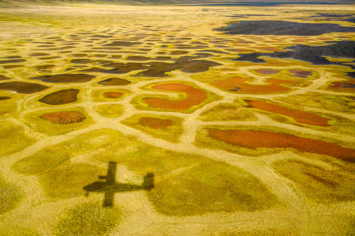
Valley bottoms in this ‘Arctic desert’ include the vibrant color of the vegetation: yellows, greens, and reds mark a dense ground. // Photo by Robie Macdonald/University of Manitoba
The marvels of Banks Island
The following post from Kathryn Hansen/NASA Earth Observatory, and Robie Macdonald/University of Manitoba/Dept. of Fisheries and Oceans, was published on NASA’s site:
In a typical year, perhaps a dozen people visit Auluvik National Park in Canada’s Northwest Territories. Luckily, one of those visitors brought back some outstanding photos.
In November 2020, we highlighted a few compelling features around the Thomsen River estuary on Banks Island, including lines of sea ice tracing the shoreline and the braided pattern of the river. But there’s so much more to explore across this remote lowland tundra and river valley.
Robie Macdonald, a scientist at the University of Manitoba, shared some photos that he shot while doing fieldwork in the region between 2014 and 2016. The purpose of that project, led by Matt Alkire of the University of Washington, was to collect geochemical measurements from small rivers across the Canadian Arctic Archipelago.
“I really do love working in these places,” Macdonald said. “Once the aircraft has landed, one is bathed in a tremendous silence broken only by waves breaking on shingle. Then you have this incredible tundra spreading out toward the hills that define the river floodplain.”
To read more and to see 10 of Robie Macdonald’s favourite photographs, click here.


