


Stories from the Field: Water quality sampling at the UM stormwater retention SmartPond
M.Sc. student Ago Fischer details a day of sampling stormwater retention ponds
My name is Agoston Fischer, or Ago for short, and I am an M.Sc. student at the Centre of Earth Observation Science (CEOS). We are part of the Faculty of Environment, Earth, and Resources at the University of Manitoba, and my supervisor is Dr. David Barber. My thesis is focused on observing the natural conditions affecting water-leaving radiance across various water types on the freshwater-brackish-marine spectrum. Data collection for this project involves low-altitude RPAS (remotely piloted aircraft system, or drone) flights in combination with in-situ water sampling.
For the 2020 field season, CEOS research associate and drone technician Madison Harasyn and I are sampling two distinct stormwater retention ponds at the University of Manitoba SmartPark once a week. Sampling began in June and is planned to continue until the end of September; this is an overview of our field work day on the fifth of August.
To start off the day, we load up our truck at the Sea Ice Research Facility (SERF) with the boat in tow and all of our equipment: the drone and its cameras, an Idronaut CTD probe, an ASD handheld spectroradiometer, a Secchi disc, and a cooler for storing water samples. Both of the ponds are close by, so we are lucky enough to be able to use SERF as a convenient base of operations.
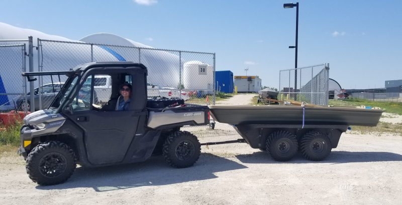
CEOS Research Associate Madison Harasyn with a truck full of supplies for sampling stormwater systems
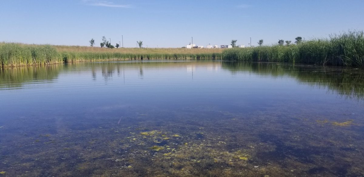
Sampling begins at the west pond, which is a naturalized stormwater retention pond surrounded by emergent vegetation such as cattails. We have spotted many red-winged blackbirds, ducks and ducklings, and a few migrating American white pelicans here over the summer. Upon our arrival we make a few observations and jot them down in our field notes, these include: the percentage of cloud cover in the sky, the estimated wind speed as per the Beaufort wind scale, the wind’s direction, and the growth of vegetation in and around the pond.
Stormwater retention pond
Before taking the boat on the pond, Madison flies the drone, a DJI M210 RTK model, over the pond in two flight paths. One of these flights is an L-shaped transect across the pond from shore to shore at an altitude of 25 feet. The other flight is higher, at around 175 feet, depending on the wind speed that day. Using images captured from the second flight we can later stitch together an image of the entire pond, which is then called an orthomosaic.
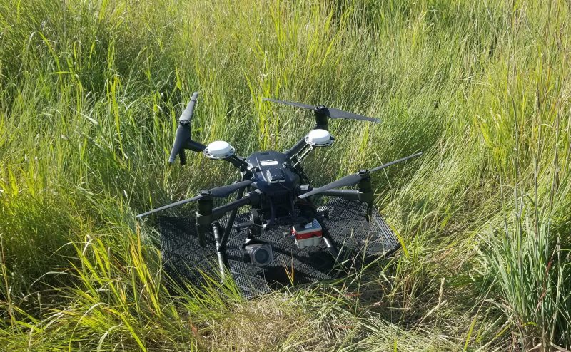
DJI M210 RTK model drone
The camera attached to the bottom of the drone during these flights is the MicaSense Altum, which is a multi-spectral camera, meaning it has multiple lenses with different filters that each take a picture simultaneously. These images can be used to see how much blue, green, and red light was captured by the drone at one spot, while near-infrared and longwave infrared imagery are also captured. Before and after each flight we hold the drone over a barium-sulfate reflectance panel and take a picture. We can use these panel images during processing to measure the solar irradiance on the ground and calibrate the flight images accordingly.
After flying the drone, we push the boat into the pond with all of our water sampling equipment in it. Using a GPS, we navigate to a consistent spot on the pond and set up. Here, the ASD handheld spectroradiometer is used to measure the reflectance of the water. This process also involves using a reflectance panel for calibration much like the one for the drone camera. The ASD is a hyperspectral sensor, meaning it takes very high resolution measurements that tell us how much light is being reflected back from the water at many different wavelengths. The range of wavelengths it measures includes those of the various filters of the Altum camera attached to the drone. Using the ASD, we can essentially get a “close-up” of the water that we can compare to the images from the drone.
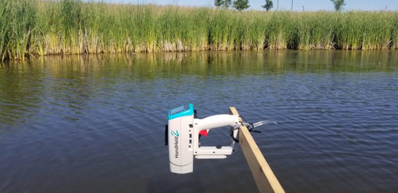
ASD handheld spectroradiometer
After using the ASD, we take a water sample with a bottle, rinsing and shaking it three times with surface water before taking the final sample from slightly below the surface. From the sample bottle, we take a subsample for algal community analysis into a smaller vial that contains Lugol’s preservative. One of these vials is pictured below, the dark colour of its contents is due to the preservative.
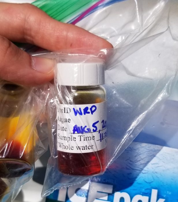
Sample from stormwater retention pond
We also take a profile of the water using the Idronaut CTD probe, where CTD stands for conductivity, temperature, and depth. A Secchi disc, 30 cm wide and painted black and white, is lowered into the water and used to visually indicate water clarity; this is measured by the depth at which the white portion can no longer be seen. A simple thermometer is used to measure temperature in the air and on the water’s surface.
After we finish our field work at the west pond, we head back to SERF for lunch before heading back out to the east pond. While our sampling routine at the east pond is the same, the pond itself is quite different. It is about a meter shallower and generally more turbid than the west pond, and is classified as a conventional stormwater retention pond as opposed to a naturalized one.
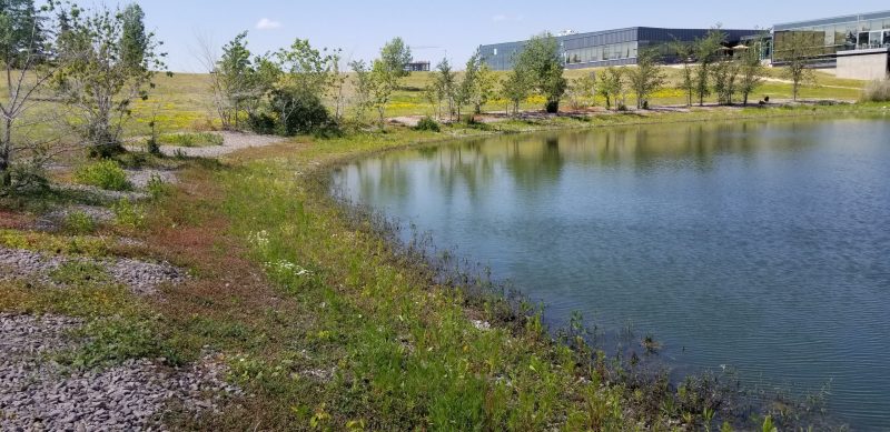
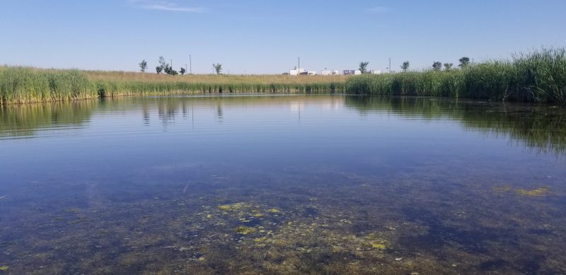
Stormwater retention SmartPond
The east pond is surrounded by rocks and does not have the same tall grasses and cattails surrounding it. Vegetation has slowly covered the rocks over the past few weeks, but in June the shore was still relatively bare. While the majority of them are geese, birds frequent this pond as well. We have spotted pelicans stopping to rest here too, and what I believe to be a double-crested cormorant, although I am not an ornithologist!
The east pond has an algae advisory sign, pictured below, that the west pond does not. Toxic blue-green algae blooms are notorious for washing up on the shores of Lake Winnipeg and have been spotted here as well. One of the goals of our research is to contribute to the advancement of water quality monitoring techniques that allow for the early detection of events such as harmful algae blooms.
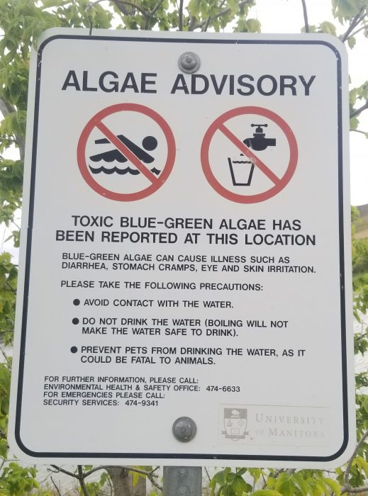
Toxic blue-green algae advisory sign at the retention pond
After we finish sampling for the day, I take our water samples back to our lab at CEOS, where the bottles are refrigerated overnight. I filter them the following day, giving the filter papers 24 hours to dry in a desiccator before freezing them for future analysis of parameters such as chlorophyll-a, total suspended solids, suspended phosphorus, and various others. The results from these analyses will tell us about the optical properties of the water and its levels of nutrients such as phosphorus and nitrogen. This knowledge can help us understand our ASD measurements and drone imagery, as well as provide insights for beneficial management practices of the retention ponds.
This story was originally published on the Lake Winnipeg Basin Initiative website:
https://lwbin.cc.umanitoba.ca/a-day-in-the-field-sampling-the-smartpark-retention-ponds/