


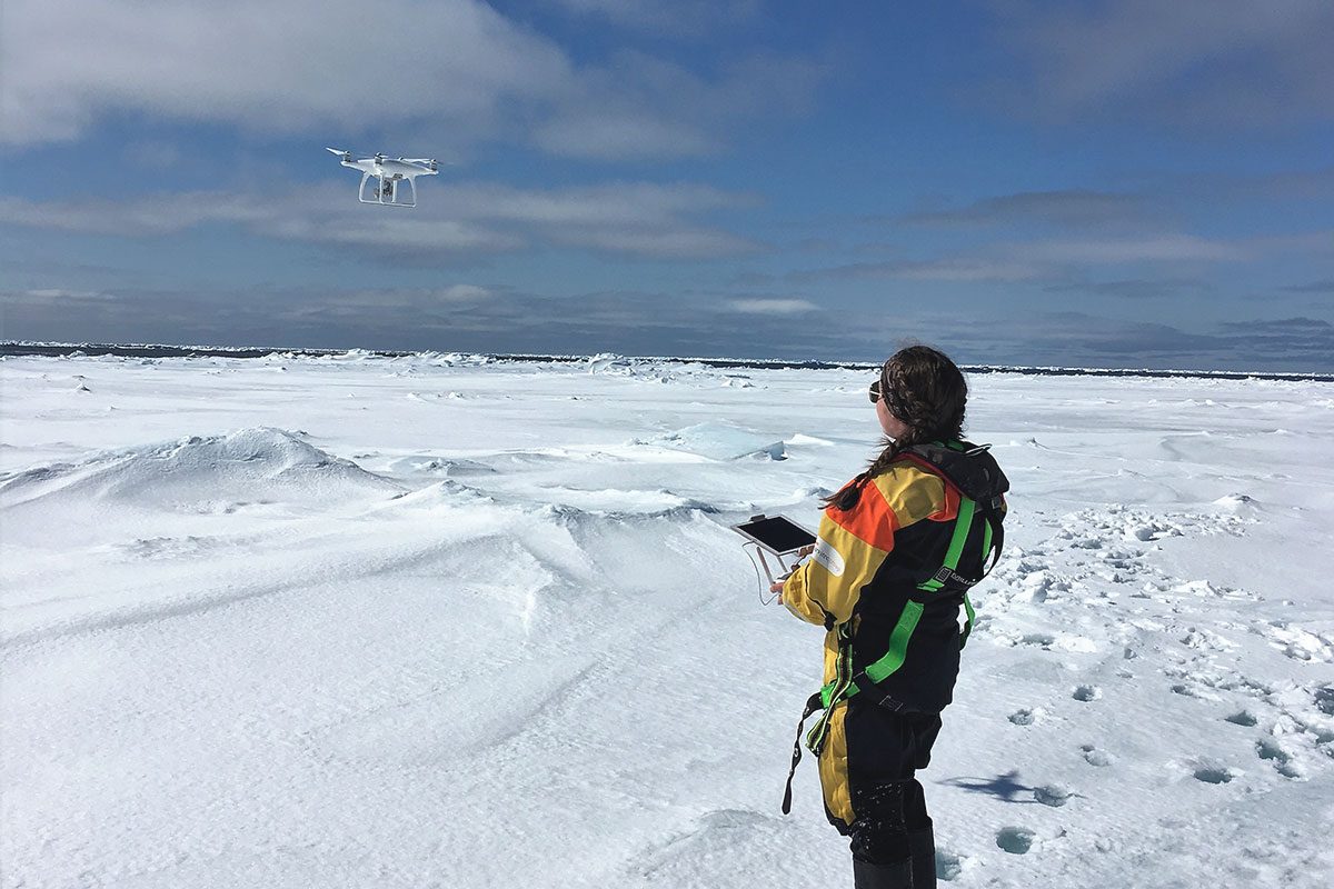
Madison flying a drone over sea ice.
Drone surveys of Hudson Bay sea ice
Nothing is more exciting to an ice scientist than waking up at 6 a.m., knowing that you will be setting foot on sea ice just after breakfast. My morning routine before ice sampling involves checking the drone cameras and batteries, gathering the ice surveying equipment, and eating a massive breakfast to hold me for the upcoming six hours of ice sampling. After this, myself and nine other scientists pull our full body immersion suits over our heads and line up to embark on our day long adventure.
This year aboard the CCGS Amundsen, I am conducting aerial surveys of the sea ice within Hudson Bay using a combination of drones and a helicopter camera. From this, I will calculate ice concentrations and classify surface features across the area in efforts to better understand ice processes in Hudson Bay during ice melt. I will also be generating elevation models to determine the surface roughness of the ice floes and ice thickness. Completing a successful drone survey in the Arctic has many associated complications – freezing temperatures, minimal GPS signal, persistent fog and high wind speeds. This has greatly limited the use of drones for Arctic applications, making these surveys unique.
Completing a drone survey on sea ice is pretty similar to flying a drone off of land. When I first get onto an ice floe I find a flat, dry patch of ice to set up the drone and program a survey flight path for the drone to take. This way, the drone can automatically fly transects above the ice over a specific area using GPS location. The most complicated part of drone flight over ice is landing, as the ice moves under the drone while it is flying a survey. This means that when the drone positions itself to land, manual override is necessary to position it back to its original take-off position so the drone does not land in open water.
Since aerial imagery can be viewed immediately after collection, it can be used to select location for targeted sampling, or to draw connections between measured physical properties and what the ice surface looks like. Measurements of the spatial distribution of under-ice algae or emitted radiation can be mapped across an ice floe using collected drone imagery, adding an element of local spatial scale to our research. Collaboration of scientists on board allows for more efficient data collection and for the discovery of some unique interdisciplinary results! A special thank you to Manitoba Hydro, NSERC Discovery Grant, and CERC/CRC who helped fund and make this BaySys project possible.