


Revealed: The cultural landscape of Fort Garry campus
Report recognizes the Indigenous and environmental histories of the lands, will help inform planning and design
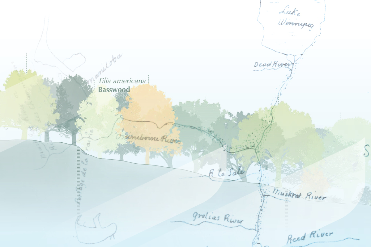
Imagine the Fort Garry campus without buildings, concrete or any of the structures we see today: The common understanding of the ‘pre-development’ landscape and surrounding region is that it was a vast, ‘untouched’ expanse of prairie.
On the contrary, the lands and riverbank landscape on which the University of Manitoba Fort Garry campus is situated have a rich history of culture and use going back well before the construction of the first Manitoba Agricultural College buildings in 1911.
A new report released by the campus planning office within the Associate Vice-President (Administration) portfolio explores the pre-colonial history of the lands, and will be used as a tool to help inform the planning and design of the Fort Garry campus.
The report recognizes the Indigenous and environmental histories of the lands as visible and significant components of the campus environment, and as a crucial part of campus’s culture, heritage and identity.
The Cultural Landscape of the Fort Garry Campus: Landform, Use, and Occupancy Prior to 1900 [pdf] recognizes the Indigenous and environmental histories of the lands as visible and significant components of the campus environment, and as a crucial part of campus’s culture, heritage and identity. The document supports the University’s strategic priorities, and offers themes, ideas and issues to be explored and further developed when undertaking planning and design work.
It also builds upon the Visionary (re)Generation Master Plan for the Fort Garry campus master plan and UM’s Indigenous Planning and Design Principles, created several years ago in consultation with Indigenous partners on campus and under the guidance of an Indigenous Advisory Committee and Subcommittee.
Read on for some interesting facts and themes revealed in The Cultural Landscape of the Fort Garry Campus.
Relationships, Reconciliation, and campus design
The centrality of relationships is a strong theme throughout the history of the Fort Garry campus land and region, along with the importance of reciprocity, and of continually maintaining those relationships.
While not intended as exhaustive or authoritative, The Cultural Landscape of the Fort Garry Campus report represents a starting point in reflecting the numerous and complex Indigenous histories of the campus region.
Significant research was conducted specifically for the cultural landscape project, including by student researchers Naithan Legace and Jordan Mykietowich.
The document also relies on Niigaanwewidam James Sinclair’s research on First Nations histories, traditional knowledges, and land uses in the southern Manitoba region, from his 2016 Manitoba-Minnesota Transmission Project report; Adele Perry’s expertise and review helped to shape and guide the document.
The themes in The Cultural Landscape of the Fort Garry Campus: Landform, Use, and Occupancy Prior to 1900 echo themes that emerged in the previously created Indigenous Planning and Design Principles, which had as its first principle to ‘commit to relationships and listening.’
“The new cultural history document provides important information and lessons for us as a UM community,” says Andrew Konowalchuk, Associate Vice-President (Administration). “As we move forward, it is crucial that we continually integrate relationship building and reciprocity into present and future processes for campus planning and design projects.
”We want to continue to create a campus where Indigenous cultures, perspectives and histories are meaningfully and visibly present.”
Access the full report on the Our Campuses webpage under “Indigenous Spaces on Campus.”


 used by Anishinaabeg.")


Did you know?
Interesting facts about the campus’s precolonial land use and occupancy
- The province’s name itself is attributed to several First Nations languages and meanings: Manitou and wapow, referring to ‘great spirit’ and ‘sacred water’ in Cree, or Manito-bau in Anishinaabemowin. The land has long been understood as Manito Ka Apit, meaning ‘where the creator sits.’
- The present-day campus is also situated within the Red River Settlement, where Métis identity flourished into a new distinct culture, and becoming known and established as the traditional homeland of the Métis Nation.
- Formally established in 1811-12, the RR Settlement was actually precipitated in the 1790s when a group of Anishinaabeg and Cree, led by Chief Peguis, established the first settlement in the northern portion.
- The campus sits within Treaty 1 Territory, one of five Treaty Territories in Manitoba, as well as within the 1817 Peguis-Selkirk Treaty area along the Red River stretching along from Lake Winnipeg into what is now North Dakota.
- Indigenous ways of understanding the land and mapping have been intrinsically centered on relationships through their characteristics, teachings, and demonstrations of roles—which became organizing principles for communities and social structures. This is contrasted with Western mapping practices.
- This context provides perspective on the campus lands as existing within a long and deep history of relationships between people, and with the land. The chiefs’ signatures on the treaty, represented by Nindoodemag (totemic markers) exemplify this, as these signatures represented “a path of experiences, history and life,” and spoke to their region of the world as “a network of humans, animals, water, and land along the Red River.”
- Indigenous relationships to the land include precolonial examples of resource harvesting, controlled burns and farming practices, and usage tied to the land, water and animals of the region based in deep knowledge of the complex environment.
- The Red River was both socially meaningful and geographically significant, with bends and points in the riverbank used as wayfinding markers along the all-season transportation route and waterway.
- Several land trails that ran adjacent to and through the campus lands were long established by First Nations’ peoples.
- Today, a number of Manitoba’s present-day roads loosely follow these same routes.
Access the full report on the Our Campuses webpage under “Indigenous Spaces on Campus.”