


Researchers Claire and Greg collecting water samples from Lake Waterhen
The Manitoba Great Lakes Project
This project began as a means to develop a better understanding of how major nutrients and contaminants move through three of the largest lakes leading into Lake Winnipeg – Lakes Waterhen, Manitoba, and Winnipegosis.
Lakes Winnipegosis and Manitoba are the 11th and 13th largest freshwater lakes in Canada yet Lake Manitoba has undergone only 2 spatial water quality surveys (1960’s, mid-2000’s) and Lake Winnipegosis has never had a complete survey. Lake Waterhen is the only certified sustainable fishery for pike in the Western Hemisphere, yet it also has no long term record of water quality. All three lakes are surrounded by First Nation and other communities that rely on these waters for recreation, food and drinking.
These lakes are also part of the Hudson Bay watershed, which is almost 1 million km2 in area, spans four Canadian provinces and four U.S. States and contains 6% of Canada’s population.
As you can imagine, the areas surrounding these lakes are very diverse. As you travel from the north end of Lake Winnipegosis to the south end of Lake Manitoba, the landscape changes from areas dominated by wetlands, forest, shrubland, and cattle farming to a landscape dominated by croplands, groomed lawns and sandy beaches. Limestone cliffs and salt plains are dotted along the west side of Lake Manitoba to Lake Winnipegosis.
In 2012, Dr. David Barber, (Associate Dean of Research and Distinguished Professor from the Centre for Earth Observation Science, University of Manitoba) and colleagues began deploying three moorings (one in the south end of Lake Winnipegosis, one in the north end of Lake Manitoba, and one in the center of Lake Waterhen), to collect in-situ measurements for chlorophyll a, phycocyanin, turbidity, temperature and pressure. By combing this data with site-specific water quality information, we are able to gather a much more detailed picture of the state of these lakes.
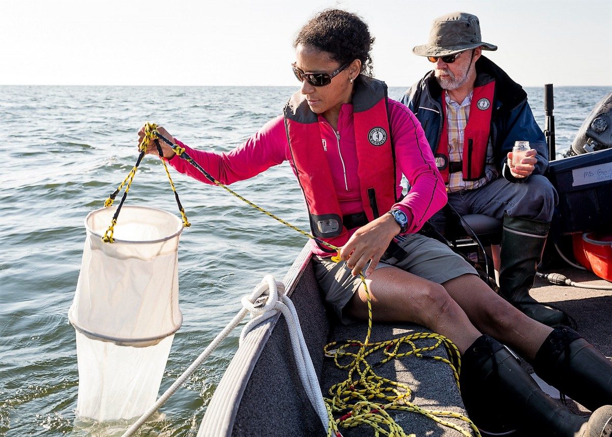
In 2016 I started my Masters Research project on the lakes, with a focus on developing or modifying existing algorithms to use remotely sensed imagery to remotely monitor algal concentrations, temperature and turbidity. Using a 16 foot Lowe boat, or a KingFisher jet boat, sampling stations were established on Lake Manitoba, Lake Winnipegosis and Lake Waterhen, as well as five major rivers (Overflowing, Red Deer, Waterhen, the Narrows and Fairford). Whole water was collected for nutrients (suspended and dissolved carbon, nitrogen and phosphorous), chlorophyll, total suspended solids, conductivity, suspended organic matter and pH. To gain a better understanding of the biological systems, algae and zooplankton were also collected. Samples were filtered either in the field or in labs at the Centre for Earth Observation Science (CEOS).
Additional collaborators include the Province of Manitoba (MB) and Environment and Climate Change Canada (ECCC). In total, approximately 188 water samples (surface and bottom) were collected and analyzed, with an additional 43 surface samples and data provided by MB and ECCC.
Development of the satellite algorithm and analysis of sample data is currently underway. Data and reporting for the MBGL project are housed with the Canadian Watershed Information Network (CanWIN) data hub (http://lwbin-datahub.ad.umanitoba.ca/). The project page with images is located on the CanWIN at http://lwbin-dev.cc.umanitoba.ca/mbgl.